ꯐꯥꯏꯜ:SakastanMap.jpg

ꯃꯁꯤꯒꯤ ꯄ꯭ꯔꯚꯤꯌꯨ ꯑꯁꯤꯒꯤ ꯁꯥꯏꯓ: ২২০ × ১৮০ ꯄꯤꯛꯆꯦꯜꯁ. ꯑꯇꯩ ꯁꯦꯡꯅ ꯌꯦꯡꯕ ꯌꯥꯕ: ২৯৪ × ২৪০ ꯄꯤꯛꯆꯦꯜꯁ | ১,৩৫৬ × ১,১০৯ ꯄꯤꯛꯆꯦꯜꯁ.
ꯐꯥꯏꯜ ꯑꯁꯦꯡꯕ (১,৩৫৬ × ১,১০৯ ꯄꯤꯛꯆꯦꯜꯁ, ꯐꯥꯏꯜ ꯆꯥꯎꯕꯒꯤ ꯆꯥꯡ: ২৫৮ KB, MIME ꯃꯈꯜ: image/jpeg)

|
This historical map image could be re-created using vector graphics as a SVG file. This has several advantages; see Commons:Media for cleanup for more information. If a SVG form of this image is available, please upload it and afterwards replace this template with
{{vector version available|new image name}}.It is recommended to name the SVG file “SakastanMap.svg”—then the template Vector version available (or Vva) does not need the new image name parameter. |


ꯑꯇꯦꯟꯕꯥ ꯁꯟꯗꯣꯛꯅꯥ ꯇꯥꯛꯄꯥ
| ꯁꯟꯗꯣꯛꯅꯥ ꯇꯥꯛꯄꯥSakastanMap.jpg | Map of Sakastan circa 100 BCE. Own work. |
| ꯆꯩꯆꯠ | ꯲꯱ ꯖꯥꯅꯨꯋꯥꯔꯤ ꯲꯰꯰꯷ (original upload date) |
| ꯍꯧꯔꯛꯐꯛ | No machine-readable source provided. Own work assumed (based on copyright claims). |
| ꯄꯨꯊꯣꯛꯂꯤꯕ ꯃꯤ | No machine-readable author provided. World Imaging assumed (based on copyright claims). |
ꯑꯌꯥꯕꯥ
| Public domainPublic domainfalsefalse |

|
I, the copyright holder of this work, release this work into the public domain. This applies worldwide. In some countries this may not be legally possible; if so: I grant anyone the right to use this work for any purpose, without any conditions, unless such conditions are required by law. |
Captions
Add a one-line explanation of what this file represents
Map of Sakastan circa 100 B.C.
শকস্তানের মানচিত্র (আনুমানিক খ্রিষ্টপূর্ব ১০০ অব্দ)
ꯐꯥꯏꯜꯒꯤ ꯄꯨꯋꯥꯔꯤ
ꯆꯩꯆꯠ/ꯃꯇꯝꯗ ꯅꯝꯃꯨ ꯃꯇꯝ ꯑꯗꯨꯗ ꯐꯥꯏꯜ ꯑꯗꯨ ꯎꯅꯕ
| ꯆꯩꯆꯠ/ꯃꯇꯝ | ꯈꯨꯠꯄꯤꯈꯨꯖꯤꯟ | ꯄꯥꯛ ꯆꯥꯎꯕꯥ | ꯁꯤꯖꯤꯟꯅꯔꯤꯕ | ꯑꯄꯥꯝꯕ ꯐꯣꯡꯗꯣꯛ ꯎ | |
|---|---|---|---|---|---|
| ꯍꯧꯖꯤꯛꯀꯤ | ꯰꯲:꯵꯲, ꯲꯲ ꯖꯥꯅꯨꯋꯥꯔꯤ ꯲꯰꯰꯷ | 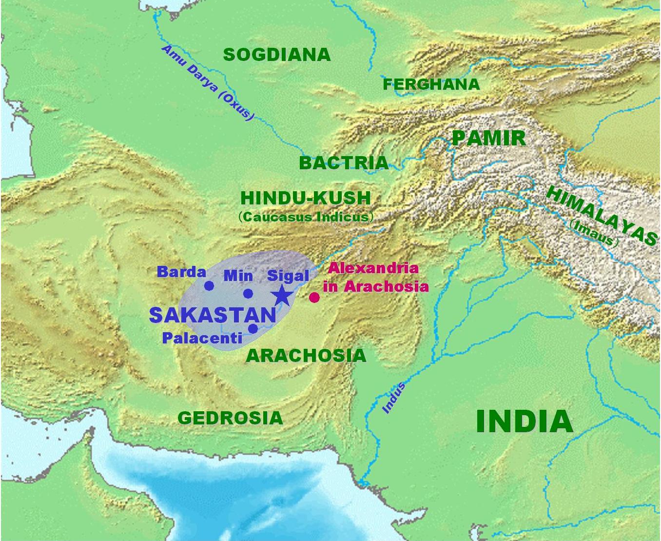 | ১,৩৫৬ × ১,১০৯ (২৫৮ KB) | smartcommons>World Imaging | More precise map, with Arachosia. |
ꯐꯥꯏꯜꯒꯤ ꯁꯤꯖꯤꯟꯅꯐꯝ
ꯃꯁꯤꯒꯤ ꯐꯥꯏꯜ ꯁꯤ ꯁꯤꯖꯤꯟꯅꯕ ꯂꯃꯥꯏꯁꯤꯡ ꯂꯩꯇꯦ ꯫
