ꯐꯥꯏꯜ:Prima tetrarchia Diocletianus.PNG

ꯃꯁꯤꯒꯤ ꯄ꯭ꯔꯚꯤꯌꯨ ꯑꯁꯤꯒꯤ ꯁꯥꯏꯓ: ২২০ × ১৫১ ꯄꯤꯛꯆꯦꯜꯁ. ꯑꯇꯩ ꯁꯦꯡꯅ ꯌꯦꯡꯕ ꯌꯥꯕ: ৩২০ × ২২০ ꯄꯤꯛꯆꯦꯜꯁ | ২,০৩৬ × ১,৩৯৭ ꯄꯤꯛꯆꯦꯜꯁ.
ꯐꯥꯏꯜ ꯑꯁꯦꯡꯕ (২,০৩৬ × ১,৩৯৭ ꯄꯤꯛꯆꯦꯜꯁ, ꯐꯥꯏꯜ ꯆꯥꯎꯕꯒꯤ ꯆꯥꯡ: ১৮০ KB, MIME ꯃꯈꯜ: image/png)

|
This historical map image could be re-created using vector graphics as a SVG file. This has several advantages; see Commons:Media for cleanup for more information. If a SVG form of this image is available, please upload it and afterwards replace this template with
{{vector version available|new image name}}.It is recommended to name the SVG file “Prima tetrarchia Diocletianus.svg”—then the template Vector version available (or Vva) does not need the new image name parameter. |
ꯑꯇꯦꯟꯕꯥ ꯁꯟꯗꯣꯛꯅꯥ ꯇꯥꯛꯄꯥ
| ꯁꯟꯗꯣꯛꯅꯥ ꯇꯥꯛꯄꯥPrima tetrarchia Diocletianus.PNG |
Català: Mapa de l'Imperi Romà amb les diòcesis creades per Dioclecià a finals del segle III dC.
English: Map of the Roman Empire with dioceses created by Diocletien. Italiano: Mappa dell'Impero romano durante la prima tetrarchia di Diocleziano. |
||
| ꯆꯩꯆꯠ | |||
| ꯍꯧꯔꯛꯐꯛ |
|
||
| ꯄꯨꯊꯣꯛꯂꯤꯕ ꯃꯤ |
|


ꯑꯌꯥꯕꯥ
I, the copyright holder of this work, hereby publish it under the following license:
| Public domainPublic domainfalsefalse |

|
I, the copyright holder of this work, release this work into the public domain. This applies worldwide. In some countries this may not be legally possible; if so: I grant anyone the right to use this work for any purpose, without any conditions, unless such conditions are required by law. |
Original upload log
This image is a derivative work of the following images:
- File:Roman Empire with dioceses in 300 AD.png licensed with PD-self
- 2009-03-10T12:34:18Z Mandrak 2052x1414 (223180 Bytes) Erreurs corrigées.
- 2009-03-03T20:03:56Z Mandrak 2052x1414 (223409 Bytes) {{Information |Description={{en|1=Map of the Roman Empire with dioceses created by Diocletien.}} {{fr|1=Carte de l'Empire romain avec les diocèses créés par l'empereur Dioclétien.}} |Source=travail personnel (own work) |A
Uploaded with derivativeFX
Captions
Add a one-line explanation of what this file represents
Mapa de l'Imperi Romà amb les diòcesis creades per Dioclecià a finals del segle III dC.
ꯐꯥꯏꯜꯒꯤ ꯄꯨꯋꯥꯔꯤ
ꯆꯩꯆꯠ/ꯃꯇꯝꯗ ꯅꯝꯃꯨ ꯃꯇꯝ ꯑꯗꯨꯗ ꯐꯥꯏꯜ ꯑꯗꯨ ꯎꯅꯕ
| ꯆꯩꯆꯠ/ꯃꯇꯝ | ꯈꯨꯠꯄꯤꯈꯨꯖꯤꯟ | ꯄꯥꯛ ꯆꯥꯎꯕꯥ | ꯁꯤꯖꯤꯟꯅꯔꯤꯕ | ꯑꯄꯥꯝꯕ ꯐꯣꯡꯗꯣꯛ ꯎ | |
|---|---|---|---|---|---|
| ꯍꯧꯖꯤꯛꯀꯤ | ꯱꯰:꯱꯲, ꯱꯲ ꯐꯦꯕꯨꯋꯥꯔꯤ ꯲꯰꯲꯲ | 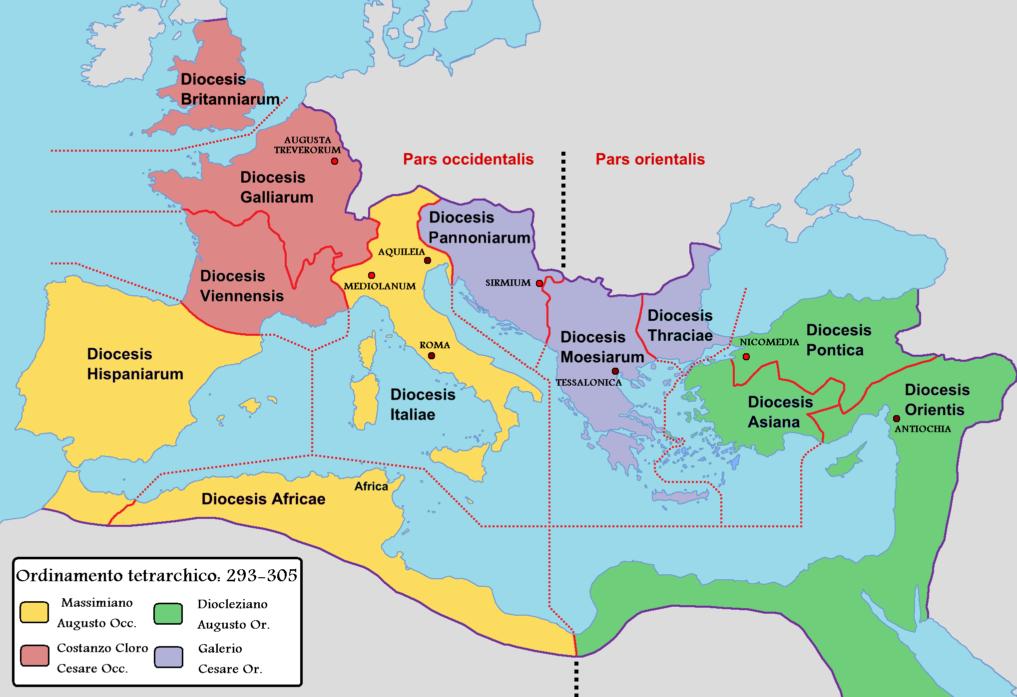 | ২,০৩৬ × ১,৩৯৭ (১৮০ KB) | smartcommons>Lojwe | Frame removed |
ꯐꯥꯏꯜꯒꯤ ꯁꯤꯖꯤꯟꯅꯐꯝ
ꯃꯁꯤꯒꯤ ꯐꯥꯏꯜ ꯁꯤ ꯁꯤꯖꯤꯟꯅꯕ ꯂꯃꯥꯏꯁꯤꯡ ꯂꯩꯇꯦ ꯫
