ꯐꯥꯏꯜ:Kongka Pass claim lines (1962).jpg
.jpg)
ꯃꯁꯤꯒꯤ ꯄ꯭ꯔꯚꯤꯌꯨ ꯑꯁꯤꯒꯤ ꯁꯥꯏꯓ: ২২০ × ১৮৫ ꯄꯤꯛꯆꯦꯜꯁ. ꯑꯇꯩ ꯁꯦꯡꯅ ꯌꯦꯡꯕ ꯌꯥꯕ: ২৮৫ × ২৪০ ꯄꯤꯛꯆꯦꯜꯁ | ১,৪৪৯ × ১,২১৯ ꯄꯤꯛꯆꯦꯜꯁ.
ꯐꯥꯏꯜ ꯑꯁꯦꯡꯕ (১,৪৪৯ × ১,২১৯ ꯄꯤꯛꯆꯦꯜꯁ, ꯐꯥꯏꯜ ꯆꯥꯎꯕꯒꯤ ꯆꯥꯡ: ৫৫৮ KB, MIME ꯃꯈꯜ: image/jpeg)
ꯑꯇꯦꯟꯕꯥ ꯁꯟꯗꯣꯛꯅꯥ ꯇꯥꯛꯄꯥ
| ꯁꯟꯗꯣꯛꯅꯥ ꯇꯥꯛꯄꯥKongka Pass claim lines (1962).jpg |
English: 1956 claim line in green, 1960 claim line in dark brown, and 1962 ceasefire line orange
Legend:
|
| ꯆꯩꯆꯠ | |
| ꯍꯧꯔꯛꯐꯛ | https://openresearch-repository.anu.edu.au/handle/1885/187645 |
| ꯄꯨꯊꯣꯛꯂꯤꯕ ꯃꯤ | US Army Headquarters, Survey Company |
| Other versions |


.jpg)
ꯑꯌꯥꯕꯥ
| Public domainPublic domainfalsefalse |

|
This file is a work of a U.S. Army soldier or employee, taken or made as part of that person's official duties. As a work of the U.S. federal government, it is in the public domain in the United States.
|
 |
Captions
Add a one-line explanation of what this file represents
Chinese claim lines near the Kongka Pass
ꯐꯥꯏꯜꯒꯤ ꯄꯨꯋꯥꯔꯤ
ꯆꯩꯆꯠ/ꯃꯇꯝꯗ ꯅꯝꯃꯨ ꯃꯇꯝ ꯑꯗꯨꯗ ꯐꯥꯏꯜ ꯑꯗꯨ ꯎꯅꯕ
| ꯆꯩꯆꯠ/ꯃꯇꯝ | ꯈꯨꯠꯄꯤꯈꯨꯖꯤꯟ | ꯄꯥꯛ ꯆꯥꯎꯕꯥ | ꯁꯤꯖꯤꯟꯅꯔꯤꯕ | ꯑꯄꯥꯝꯕ ꯐꯣꯡꯗꯣꯛ ꯎ | |
|---|---|---|---|---|---|
| ꯍꯧꯖꯤꯛꯀꯤ | ꯲꯲:꯱꯶, ꯲꯱ ꯖꯨꯟ ꯲꯰꯲꯲ | 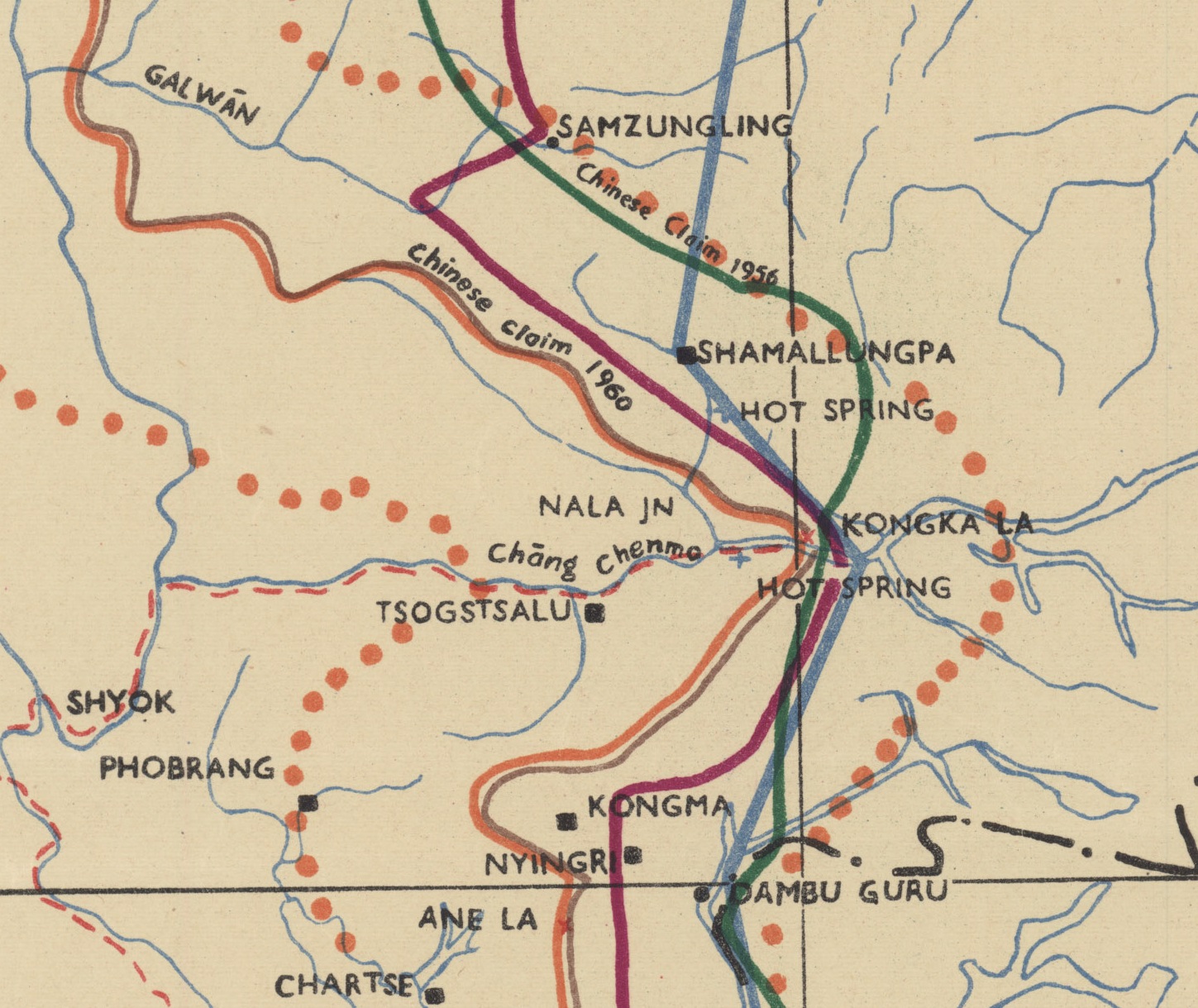 | ১,৪৪৯ × ১,২১৯ (৫৫৮ KB) | smartcommons>Kautilya3 | Uploaded a work by US Army Headquarters, Survey Company from https://openresearch-repository.anu.edu.au/handle/1885/187645 with UploadWizard |
ꯐꯥꯏꯜꯒꯤ ꯁꯤꯖꯤꯟꯅꯐꯝ
ꯃꯁꯤꯒꯤ ꯐꯥꯏꯜ ꯁꯤ ꯁꯤꯖꯤꯟꯅꯕ ꯂꯃꯥꯏꯁꯤꯡ ꯂꯩꯇꯦ ꯫
.jpg)