ꯐꯥꯏꯜ:CaronMap.jpg

ꯃꯁꯤꯒꯤ ꯄ꯭ꯔꯚꯤꯌꯨ ꯑꯁꯤꯒꯤ ꯁꯥꯏꯓ: ২২০ × ১৫০ ꯄꯤꯛꯆꯦꯜꯁ. ꯑꯇꯩ ꯁꯦꯡꯅ ꯌꯦꯡꯕ ꯌꯥꯕ: ৩২০ × ২১৮ ꯄꯤꯛꯆꯦꯜꯁ | ৫১৪ × ৩৫০ ꯄꯤꯛꯆꯦꯜꯁ.
ꯐꯥꯏꯜ ꯑꯁꯦꯡꯕ (৫১৪ × ৩৫০ ꯄꯤꯛꯆꯦꯜꯁ, ꯐꯥꯏꯜ ꯆꯥꯎꯕꯒꯤ ꯆꯥꯡ: ১৪০ KB, MIME ꯃꯈꯜ: image/jpeg)
ꯑꯇꯦꯟꯕꯥ ꯁꯟꯗꯣꯛꯅꯥ ꯇꯥꯛꯄꯥ
English: A Perfect Map of the Situation of the Land of Iapan
(   ) ) |
||||||||||||||||||||||||
|---|---|---|---|---|---|---|---|---|---|---|---|---|---|---|---|---|---|---|---|---|---|---|---|---|
| ꯄꯨꯊꯣꯛꯂꯤꯕ ꯃꯤ |
creator QS:P170,Q1450963 |
|||||||||||||||||||||||
| Title |
English: A Perfect Map of the Situation of the Land of Iapan |
|||||||||||||||||||||||
| ꯁꯟꯗꯣꯛꯅꯥ ꯇꯥꯛꯄꯥ |
English: Map of Japan and Korea from A True Description of the Mighty Kingdoms of Japan and Siam Written Originally in Dutch by Francis Caron and Joost Schorten and Now Rendred into English by Capt. Roger Manley, the English translation of Caron's work. |
|||||||||||||||||||||||
| ꯆꯩꯆꯠ |
꯱꯶꯶꯳ date QS:P571,+1663-00-00T00:00:00Z/9 |
|||||||||||||||||||||||
| Source/Photographer | Some scan someplace | |||||||||||||||||||||||


ꯑꯌꯥꯕꯥ
|
This is a faithful photographic reproduction of a two-dimensional, public domain work of art. The work of art itself is in the public domain for the following reason:
The official position taken by the Wikimedia Foundation is that "faithful reproductions of two-dimensional public domain works of art are public domain".
This photographic reproduction is therefore also considered to be in the public domain in the United States. In other jurisdictions, re-use of this content may be restricted; see Reuse of PD-Art photographs for details. | |||||


Captions
Add a one-line explanation of what this file represents
ꯐꯥꯏꯜꯒꯤ ꯄꯨꯋꯥꯔꯤ
ꯆꯩꯆꯠ/ꯃꯇꯝꯗ ꯅꯝꯃꯨ ꯃꯇꯝ ꯑꯗꯨꯗ ꯐꯥꯏꯜ ꯑꯗꯨ ꯎꯅꯕ
| ꯆꯩꯆꯠ/ꯃꯇꯝ | ꯈꯨꯠꯄꯤꯈꯨꯖꯤꯟ | ꯄꯥꯛ ꯆꯥꯎꯕꯥ | ꯁꯤꯖꯤꯟꯅꯔꯤꯕ | ꯑꯄꯥꯝꯕ ꯐꯣꯡꯗꯣꯛ ꯎ | |
|---|---|---|---|---|---|
| ꯍꯧꯖꯤꯛꯀꯤ | ꯱꯲:꯳꯲, ꯱꯱ ꯁꯦꯞꯇꯦꯝꯕꯔ ꯲꯰꯰꯵ | 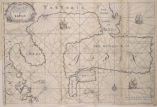 | ৫১৪ × ৩৫০ (১৪০ KB) | smartcommons>World Imaging | Map of Japan by Francois Caron. 17th century. Category: Maps |
ꯐꯥꯏꯜꯒꯤ ꯁꯤꯖꯤꯟꯅꯐꯝ
ꯃꯁꯤꯒꯤ ꯐꯥꯏꯜ ꯁꯤ ꯁꯤꯖꯤꯟꯅꯕ ꯂꯃꯥꯏꯁꯤꯡ ꯂꯩꯇꯦ ꯫
