ꯐꯥꯏꯜ:Afghanistan region during 500 BC.jpg

ꯃꯁꯤꯒꯤ ꯄ꯭ꯔꯚꯤꯌꯨ ꯑꯁꯤꯒꯤ ꯁꯥꯏꯓ: ২২০ × ২১৯ ꯄꯤꯛꯆꯦꯜꯁ. ꯑꯇꯩ ꯁꯦꯡꯅ ꯌꯦꯡꯕ ꯌꯥꯕ: ২৪১ × ২৪০ ꯄꯤꯛꯆꯦꯜꯁ | ৩৪৮ × ৩৪৭ ꯄꯤꯛꯆꯦꯜꯁ.
ꯐꯥꯏꯜ ꯑꯁꯦꯡꯕ (৩৪৮ × ৩৪৭ ꯄꯤꯛꯆꯦꯜꯁ, ꯐꯥꯏꯜ ꯆꯥꯎꯕꯒꯤ ꯆꯥꯡ: ৫৬ KB, MIME ꯃꯈꯜ: image/jpeg)
| ꯁꯟꯗꯣꯛꯅꯥ ꯇꯥꯛꯄꯥAfghanistan region during 500 BC.jpg |
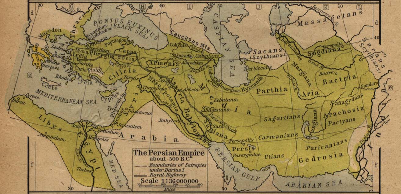
Español: Mapa histórico del Imperio Aqueménida.
English: Historic map of the Achaemenid Empire
Français : Carte historique de l'empire achéménide
Arachosia, Aria and Bactria were the ancient satraps of the Persian Achaemenid Empire that made up most of what is now Afghanistan and western Pakistan during 500 B.C. The main inhabitants of Arachosia were known as Pactyans, whose name possibly survives in today's Pakhtuns. |
|||||
| ꯆꯩꯆꯠ | ||||||
| ꯍꯧꯔꯛꯐꯛ |
http://www.lib.utexas.edu/maps/historical/history_asia.html http://www.lib.utexas.edu/maps/historical/shepherd/persian_empire.jpg |
|||||
| ꯄꯨꯊꯣꯛꯂꯤꯕ ꯃꯤ | William R. Shepherd (b. 1871 - d. 1934) | |||||
| ꯑꯌꯥꯕ ꯂꯧꯕ (ꯃꯁꯤꯒꯤ ꯐꯥꯏꯜꯁꯤ ꯑꯃꯨꯛ ꯍꯟꯅꯥ ꯁꯤꯖꯤꯟꯅꯕꯥ) |
|
|||||
| Other versions | File:Map of the Achaemenid Empire.jpg (full) | |||||



Captions
Add a one-line explanation of what this file represents
ꯐꯥꯏꯜꯒꯤ ꯄꯨꯋꯥꯔꯤ
ꯆꯩꯆꯠ/ꯃꯇꯝꯗ ꯅꯝꯃꯨ ꯃꯇꯝ ꯑꯗꯨꯗ ꯐꯥꯏꯜ ꯑꯗꯨ ꯎꯅꯕ
| ꯆꯩꯆꯠ/ꯃꯇꯝ | ꯈꯨꯠꯄꯤꯈꯨꯖꯤꯟ | ꯄꯥꯛ ꯆꯥꯎꯕꯥ | ꯁꯤꯖꯤꯟꯅꯔꯤꯕ | ꯑꯄꯥꯝꯕ ꯐꯣꯡꯗꯣꯛ ꯎ | |
|---|---|---|---|---|---|
| ꯍꯧꯖꯤꯛꯀꯤ | ꯱꯹:꯱꯸, ꯱꯲ ꯃꯥꯔꯆ ꯲꯰꯱꯰ | 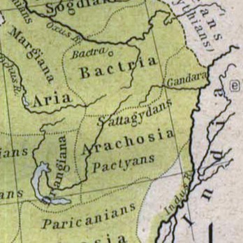 | ৩৪৮ × ৩৪৭ (৫৬ KB) | smartcommons>Officer | {{Information |Description={{es|Mapa histórico del imperio Aqueménido.}} {{en|Historic map of the Achaemenid Empire}} {{fr|Carte historique de l'empire achéménide}} |Source=http://www.lib.utexas.edu/maps/historical/history_asia.html http://www.lib.ut |
ꯐꯥꯏꯜꯒꯤ ꯁꯤꯖꯤꯟꯅꯐꯝ
ꯃꯁꯤꯒꯤ ꯐꯥꯏꯜ ꯁꯤ ꯁꯤꯖꯤꯟꯅꯕ ꯂꯃꯥꯏꯁꯤꯡ ꯂꯩꯇꯦ ꯫
