ꯐꯥꯏꯜ:BlankMap-World.png

ꯐꯥꯏꯜ ꯑꯁꯦꯡꯕ (১,৫০০ × ৭৪০ ꯄꯤꯛꯆꯦꯜꯁ, ꯐꯥꯏꯜ ꯆꯥꯎꯕꯒꯤ ꯆꯥꯡ: ৪৩ KB, MIME ꯃꯈꯜ: image/png)

ꯑꯇꯦꯟꯕꯥ ꯁꯟꯗꯣꯛꯅꯥ ꯇꯥꯛꯄꯥ

|
File:BlankMap-World.svg is a vector version of this file. It should be used in place of this PNG file.
File:BlankMap-World.png → File:BlankMap-World.svg
For more information, see Help:SVG. |
 |
| ꯁꯟꯗꯣꯛꯅꯥ ꯇꯥꯛꯄꯥBlankMap-World.png |
English:
A blank map of the world as of 2014, with country outlines, for making country locator maps. This map uses the Robinson projection, compressed at latitude direction by factor 0.95623, centered on the meridian circa 11°15' to east from Greenwich Prime Meridian and includes various microstates and island nations. All territories indicated in the UN listing of territories and regions are exhibited. Base map: File:"Political World" CIA World Factbook map 2005.svg from the CIA World Factbook (2005).[1] Bahasa Indonesia:
Peta kosong dunia sejak tahun 2014, dengan batasan negara, unutk membuat peta pencari negara. Peta ini menggunakan proyeksi Robinson, dikompresi pada arah lintang dengan faktor 0.95623, dipusatkan pada garis bujur 11°15' ke arah timur dari Prime Meridian Greenwich, dan termasuk berbagai negara kecil dan negara kepulauan. Semua wilayah yang terdaftar dalam daftar wilayah PBB ditunjukkan. Peta pendasar: File:"Political World" CIA World Factbook map 2005.svg dari CIA World Factbook (2005).[2]
|
||||||||||||
| ꯆꯩꯆꯠ | Uploaded on the 8th December of 2004. | ||||||||||||
| ꯍꯧꯔꯛꯐꯛ | original by Vardion; updated by various users since December 2004. | ||||||||||||
| ꯄꯨꯊꯣꯛꯂꯤꯕ ꯃꯤ | The map was made by Vardion and adapted by E Pluribus Anthony for Wikipedia, and Spesh531, having made about 70% of all edits. | ||||||||||||
| Other versions |
Derivative works of this file:
Version with additional miscellaneous islands at Image:BlankMap-World-alt.png. Also see v2 and v4 for versions with micro-states, v3 and v5 for versions with microstates + thin lines joining country areas, and vDisputes for version with disputed territories outlined. A version of this map is available with no disputed boundaries amd a darker grey at Image:World map model.png. Other blank maps are available at Wikipedia:Blank maps and Category:Blank maps of the world. If you plan on generating a new map for wikipedia by zooming in on this map and making some modifications, please consider a source map in SVG format instead, which will produce a higher quality image. These can be found in the SVG section at Wikipedia:Blank Maps. |
||||||||||||

![[1]](https://commons.wikimedia.org/w/index.php?title=File_talk:BlankMap-World.png&diff=53142652&oldid=53140144)


.PNG)


ꯑꯌꯥꯕꯥ
| Public domainPublic domainfalsefalse |

|
This work has been released into the public domain by its author, Vardion. This applies worldwide. In some countries this may not be legally possible; if so: |
| Annotations InfoField | This image is annotated: View the annotations at Commons |

South America
North America
Africa
Europe
Asia
Oceania
Oceania
Captions
ꯐꯥꯏꯜꯒꯤ ꯄꯨꯋꯥꯔꯤ
ꯆꯩꯆꯠ/ꯃꯇꯝꯗ ꯅꯝꯃꯨ ꯃꯇꯝ ꯑꯗꯨꯗ ꯐꯥꯏꯜ ꯑꯗꯨ ꯎꯅꯕ
| ꯆꯩꯆꯠ/ꯃꯇꯝ | ꯈꯨꯠꯄꯤꯈꯨꯖꯤꯟ | ꯄꯥꯛ ꯆꯥꯎꯕꯥ | ꯁꯤꯖꯤꯟꯅꯔꯤꯕ | ꯑꯄꯥꯝꯕ ꯐꯣꯡꯗꯣꯛ ꯎ | |
|---|---|---|---|---|---|
| ꯍꯧꯖꯤꯛꯀꯤ | ꯲꯲:꯴꯹, ꯳ ꯃꯦ ꯲꯰꯲꯵ | 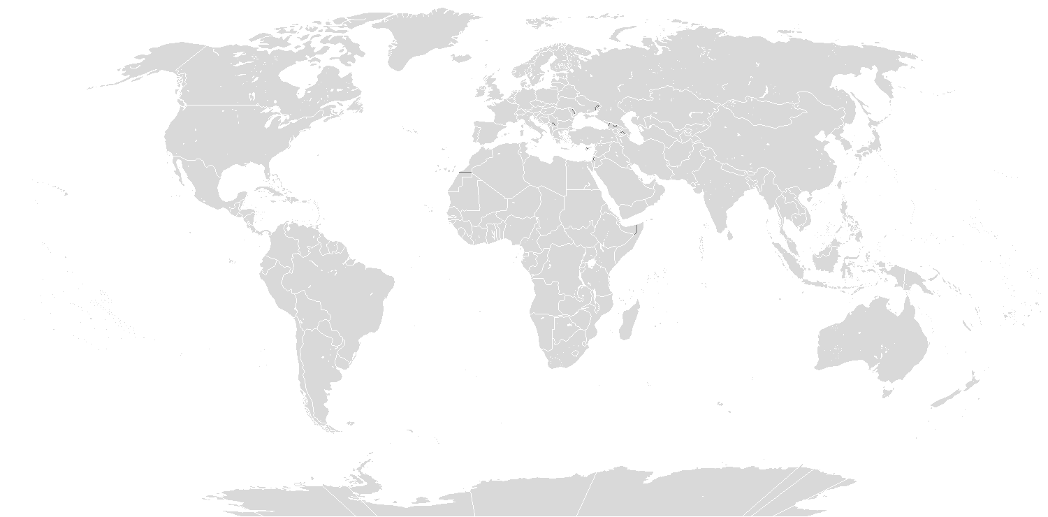 | ১,৫০০ × ৭৪০ (৪৩ KB) | smartcommons>Icantthinkofanamexd | Reverted to version as of 13:08, 10 March 2018 (UTC) South Sudan missing from map |
ꯐꯥꯏꯜꯒꯤ ꯁꯤꯖꯤꯟꯅꯐꯝ
ꯃꯁꯤꯒꯤ ꯐꯥꯏꯜ ꯁꯤ ꯁꯤꯖꯤꯟꯅꯕ ꯂꯃꯥꯏꯁꯤꯡ ꯂꯩꯇꯦ ꯫
