ꯐꯥꯏꯜ:PeriplusAncientMap.jpg

Size of this preview: ২২০ × ১৭৩ pixels. Other resolutions: ৩০৫ × ২৪০ pixels | ১,৫২৪ × ১,১৯৮ pixels.
Original file (১,৫২৪ × ১,১৯৮ pixels, file size: ২৩৯ KB, MIME type: image/jpeg)
Summary
| DescriptionPeriplusAncientMap.jpg |
English: Map by Abraham Ortelius, (1527-1598) for the Periplus Maris Erythraei (Περίπλους τὴς Ἐρυθράς Θαλάσσης "Periplus of the Erythraean Sea"), attributed to Arrian. |
|||||||||||||||||||||||
| Date | ||||||||||||||||||||||||
| Source | Plate [162] from: Theatrum orbus terrarum / Abraham Ortelius. Antverpiae: Apud Ioannem Bapt. Vrintium, 1609. | |||||||||||||||||||||||
| Author |
creator QS:P170,Q232916 |
|||||||||||||||||||||||


See also:
- http://catalogue.nla.gov.au/Record/3408384/Copyright archive copy at the Wayback Machine
- http://www.orteliusmaps.com/book/ort224.html
Licensing
|
This is a faithful photographic reproduction of a two-dimensional, public domain work of art. The work of art itself is in the public domain for the following reason:
The official position taken by the Wikimedia Foundation is that "faithful reproductions of two-dimensional public domain works of art are public domain".
This photographic reproduction is therefore also considered to be in the public domain in the United States. In other jurisdictions, re-use of this content may be restricted; see Reuse of PD-Art photographs for details. | |||||


Captions
Add a one-line explanation of what this file represents
File history
Click on a date/time to view the file as it appeared at that time.
| Date/Time | Thumbnail | Dimensions | User | Comment | |
|---|---|---|---|---|---|
| current | 13:40, 24 March 2007 | 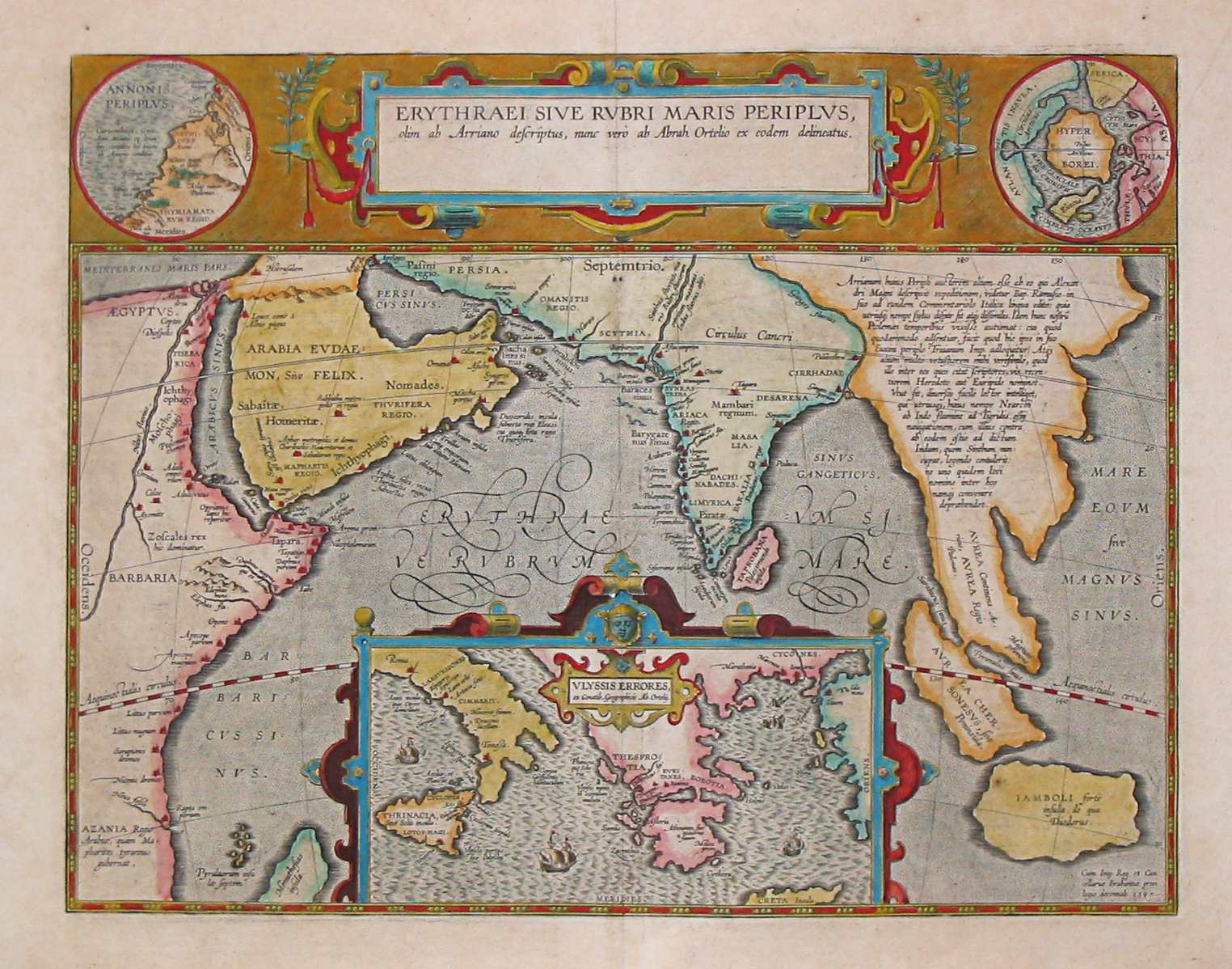 | ১,৫২৪ × ১,১৯৮ (২৩৯ KB) | smartcommons>World Imaging | Ancient map (17th century) depicting the locations of the Periplus of the Erythraean Sea. |
File usage
There are no pages that use this file.
