ꯐꯥꯏꯜ:Afghanistan region during 500 BC.jpg
Error creating thumbnail: File missing
Other resolution: ৩৪৮ × ৩৪৭ pixels.
Original file (৩৪৮ × ৩৪৭ pixels, file size: ৫৬ KB, MIME type: image/jpeg)
| DescriptionAfghanistan region during 500 BC.jpg |
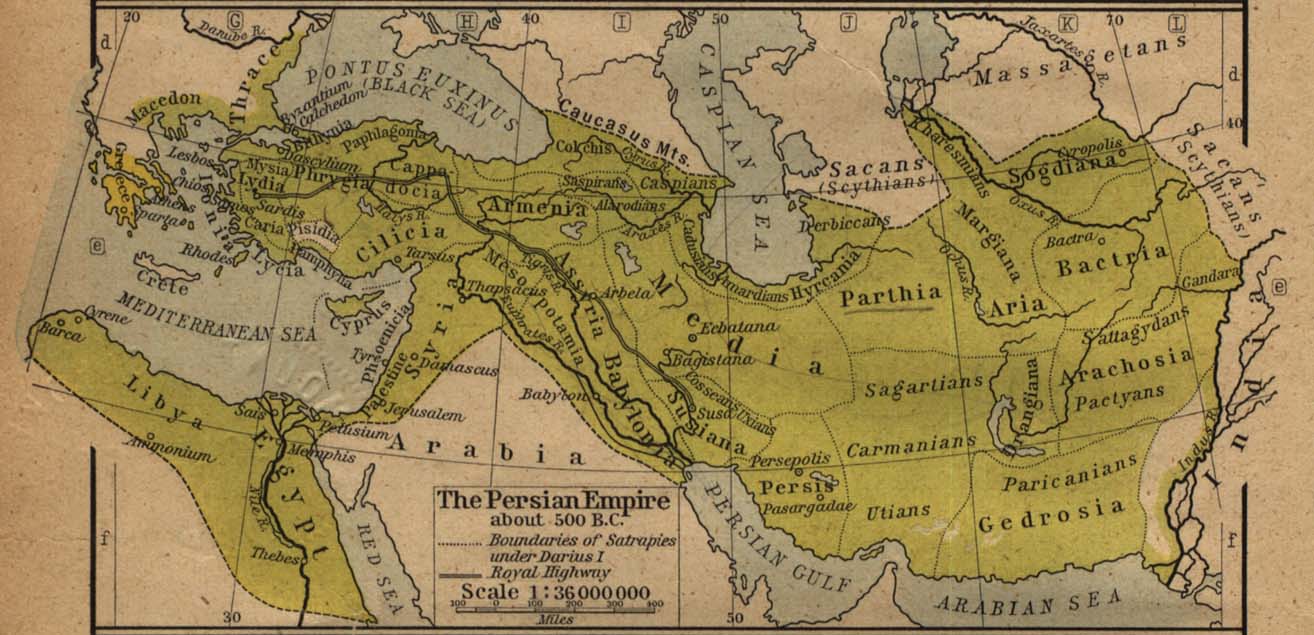
Español: Mapa histórico del Imperio Aqueménida.
English: Historic map of the Achaemenid Empire
Français : Carte historique de l'empire achéménide
Arachosia, Aria and Bactria were the ancient satraps of the Persian Achaemenid Empire that made up most of what is now Afghanistan and western Pakistan during 500 B.C. The main inhabitants of Arachosia were known as Pactyans, whose name possibly survives in today's Pakhtuns. |
|||||
| Date | ||||||
| Source |
http://www.lib.utexas.edu/maps/historical/history_asia.html http://www.lib.utexas.edu/maps/historical/shepherd/persian_empire.jpg |
|||||
| Author | William R. Shepherd (b. 1871 - d. 1934) | |||||
| Permission (Reusing this file) |
|
|||||
| Other versions | File:Map of the Achaemenid Empire.jpg (full) | |||||



Captions
Add a one-line explanation of what this file represents
File history
Click on a date/time to view the file as it appeared at that time.
| Date/Time | Thumbnail | Dimensions | User | Comment | |
|---|---|---|---|---|---|
| current | 19:18, 12 March 2010 |  | ৩৪৮ × ৩৪৭ (৫৬ KB) | smartcommons>Officer | {{Information |Description={{es|Mapa histórico del imperio Aqueménido.}} {{en|Historic map of the Achaemenid Empire}} {{fr|Carte historique de l'empire achéménide}} |Source=http://www.lib.utexas.edu/maps/historical/history_asia.html http://www.lib.ut |
File usage
There are no pages that use this file.
