ꯐꯥꯏꯜ:Topo map Attappati Reserve Forest.jpg

ꯃꯁꯤꯒꯤ ꯄ꯭ꯔꯚꯤꯌꯨ ꯑꯁꯤꯒꯤ ꯁꯥꯏꯓ: ২২০ × ১৮৯ ꯄꯤꯛꯆꯦꯜꯁ. ꯑꯇꯩ ꯁꯦꯡꯅ ꯌꯦꯡꯕ ꯌꯥꯕ: ২৭৯ × ২৪০ ꯄꯤꯛꯆꯦꯜꯁ | ৮৩৮ × ৭২১ ꯄꯤꯛꯆꯦꯜꯁ.
ꯐꯥꯏꯜ ꯑꯁꯦꯡꯕ (৮৩৮ × ৭২১ ꯄꯤꯛꯆꯦꯜꯁ, ꯐꯥꯏꯜ ꯆꯥꯎꯕꯒꯤ ꯆꯥꯡ: ৮৯৩ KB, MIME ꯃꯈꯜ: image/jpeg)

ꯑꯇꯦꯟꯕꯥ ꯁꯟꯗꯣꯛꯅꯥ ꯇꯥꯛꯄꯥ
Description: Topo Map, Attappati Reseerve Forest, Kerala, India Source: U.S. Army Topology Command [Image:Erode-topo.jpg] Date: 1959/3-6-2007 Author: U.S. Army Map Service, cropped & labeled by -Marcus Permission: Public Domain Other versions: [1] , [2]
![[1]](http://www.lib.utexas.edu/maps/ams/india/nc-43-04.jpg)
ꯑꯌꯥꯕꯥ
| Public domainPublic domainfalsefalse |

|
This file is a work of a U.S. Army soldier or employee, taken or made as part of that person's official duties. As a work of the U.S. federal government, it is in the public domain in the United States.
|
 |
Captions
Add a one-line explanation of what this file represents
ꯐꯥꯏꯜꯒꯤ ꯄꯨꯋꯥꯔꯤ
ꯆꯩꯆꯠ/ꯃꯇꯝꯗ ꯅꯝꯃꯨ ꯃꯇꯝ ꯑꯗꯨꯗ ꯐꯥꯏꯜ ꯑꯗꯨ ꯎꯅꯕ
| ꯆꯩꯆꯠ/ꯃꯇꯝ | ꯈꯨꯠꯄꯤꯈꯨꯖꯤꯟ | ꯄꯥꯛ ꯆꯥꯎꯕꯥ | ꯁꯤꯖꯤꯟꯅꯔꯤꯕ | ꯑꯄꯥꯝꯕ ꯐꯣꯡꯗꯣꯛ ꯎ | |
|---|---|---|---|---|---|
| ꯍꯧꯖꯤꯛꯀꯤ | ꯰꯱:꯰꯹, ꯴ ꯑꯦꯄꯔꯤꯜ ꯲꯰꯰꯷ | 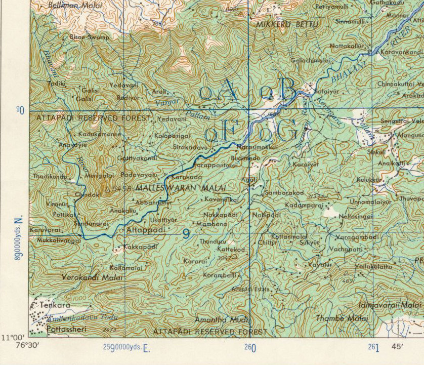 | ৮৩৮ × ৭২১ (৮৯৩ KB) | smartcommons>Marcus334 | Description: Topo Map, Attappati Reseerve Forest, Kerala, India Source: U.S. Army Topology Command [Image:Erode-topo.jpg] Date: 1959/3-6-2007 Author: U.S. Army Map Service, cropped & labeled by -Marcus Permission: Public Domain Other |
ꯐꯥꯏꯜꯒꯤ ꯁꯤꯖꯤꯟꯅꯐꯝ
ꯃꯁꯤꯒꯤ ꯐꯥꯏꯜ ꯁꯤ ꯁꯤꯖꯤꯟꯅꯕ ꯂꯃꯥꯏꯁꯤꯡ ꯂꯩꯇꯦ ꯫
