ꯐꯥꯏꯜ:Joppen map-India in 1525 published 1907 by Longmans.jpg

ꯃꯁꯤꯒꯤ ꯄ꯭ꯔꯚꯤꯌꯨ ꯑꯁꯤꯒꯤ ꯁꯥꯏꯓ: ২২০ × ৩২৩ ꯄꯤꯛꯆꯦꯜꯁ. ꯑꯇꯩ ꯁꯦꯡꯅ ꯌꯦꯡꯕ ꯌꯥꯕ: ১৬৩ × ২৪০ ꯄꯤꯛꯆꯦꯜꯁ | ১,৮৯৩ × ২,৭৮৩ ꯄꯤꯛꯆꯦꯜꯁ.
ꯐꯥꯏꯜ ꯑꯁꯦꯡꯕ (১,৮৯৩ × ২,৭৮৩ ꯄꯤꯛꯆꯦꯜꯁ, ꯐꯥꯏꯜ ꯆꯥꯎꯕꯒꯤ ꯆꯥꯡ: ১.৫৭ MB, MIME ꯃꯈꯜ: image/jpeg)

ꯑꯇꯦꯟꯕꯥ ꯁꯟꯗꯣꯛꯅꯥ ꯇꯥꯛꯄꯥ
| ꯁꯟꯗꯣꯛꯅꯥ ꯇꯥꯛꯄꯥJoppen map-India in 1525 published 1907 by Longmans.jpg |
English: A map of India in 1525 on the eve of the Mughal conquest of Upper India, scanned from the personal copy of Historical Atlas of India by Charles Joppen SJ, Longmans, Green and Co, 1907 by Fowler&fowler (ꯋꯥ ꯍꯥꯏꯐꯝ) 13:52, 10 July 2023 (UTC) |
| ꯆꯩꯆꯠ | |
| ꯍꯧꯔꯛꯐꯛ |
Map of India 1525 showing India just before the Mughal conquest of Upper India from: Joppen, Charles [SJ.] (1907) A Historical Atlas of India for the use of High-Schools, Colleges, and Private Students, London, New York, Bombay, and Calcutta: Longman Green and Co. Pp. 16, 26 maps . |
| ꯄꯨꯊꯣꯛꯂꯤꯕ ꯃꯤ | Justus Perthes, Gotha./Charles Joppen Joppen, Charles [SJ.] (1907) A Historical Atlas of India for the use of High-Schools, Colleges, and Private Students, London, New York, Bombay, and Calcutta: Longman Green and Co. Pp. 16, 26 maps |
ꯑꯌꯥꯕꯥ
| Public domainPublic domainfalsefalse |

|
This work is in the public domain in the United States because it was published (or registered with the U.S. Copyright Office) before January 1, 1931.
 Public domain works must be out of copyright in both the United States and in the source country of the work in order to be hosted on the Commons. If the work is not a U.S. work, the file must have an additional copyright tag indicating the copyright status in the source country.
Note: This tag should not be used for sound recordings.PD-1923Public domain in the United States//commons.wikimedia.org/wiki/File:Joppen_map-India_in_1525_published_1907_by_Longmans.jpg |
Captions
Add a one-line explanation of what this file represents
A map of India in 1525 on the eve of the Mughal conquest of Upper India
ꯐꯥꯏꯜꯒꯤ ꯄꯨꯋꯥꯔꯤ
ꯆꯩꯆꯠ/ꯃꯇꯝꯗ ꯅꯝꯃꯨ ꯃꯇꯝ ꯑꯗꯨꯗ ꯐꯥꯏꯜ ꯑꯗꯨ ꯎꯅꯕ
| ꯆꯩꯆꯠ/ꯃꯇꯝ | ꯈꯨꯠꯄꯤꯈꯨꯖꯤꯟ | ꯄꯥꯛ ꯆꯥꯎꯕꯥ | ꯁꯤꯖꯤꯟꯅꯔꯤꯕ | ꯑꯄꯥꯝꯕ ꯐꯣꯡꯗꯣꯛ ꯎ | |
|---|---|---|---|---|---|
| ꯍꯧꯖꯤꯛꯀꯤ | ꯱꯹:꯲꯲, ꯱꯰ ꯖꯨꯂꯥꯏ ꯲꯰꯲꯳ | 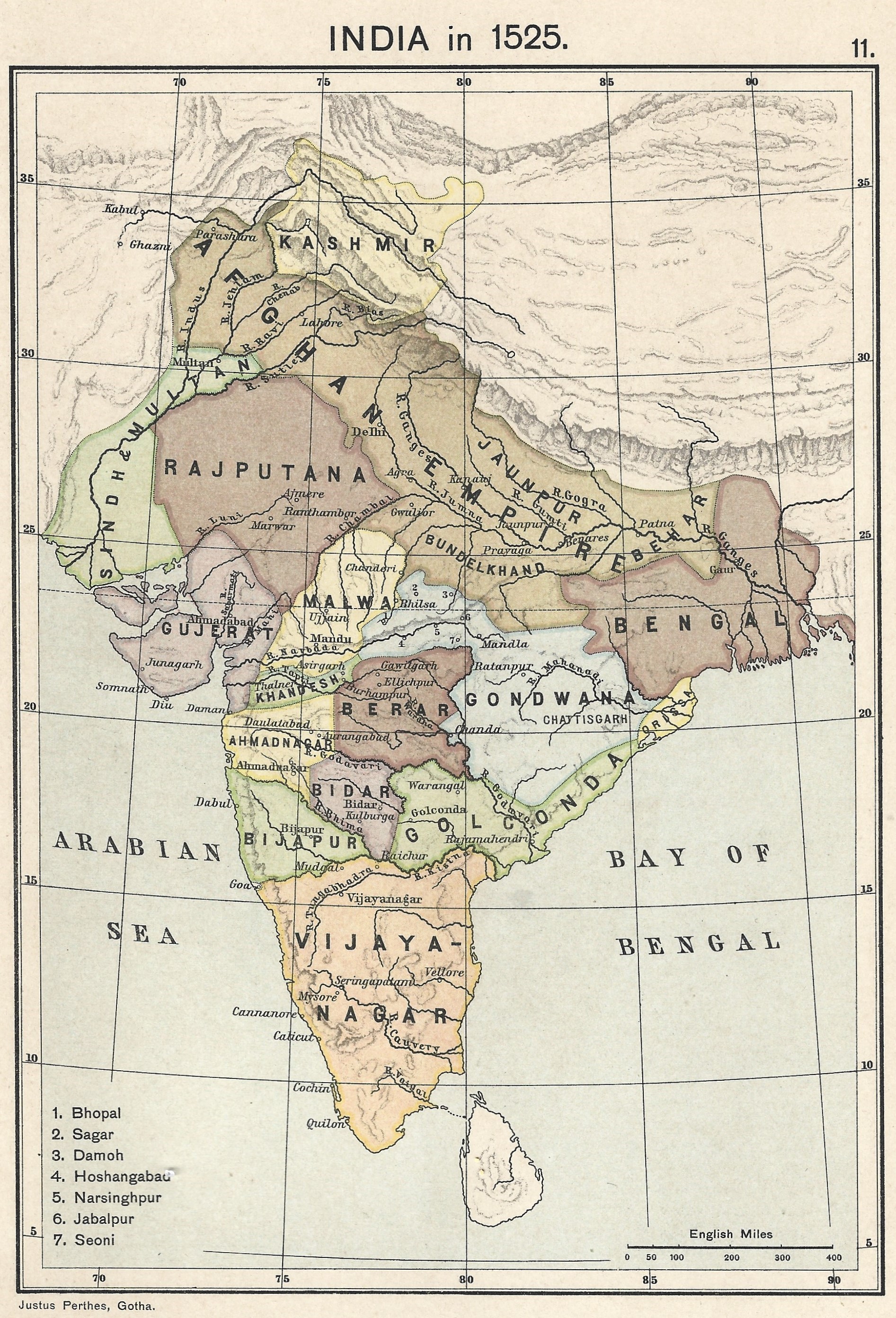 | ১,৮৯৩ × ২,৭৮৩ (১.৫৭ MB) | smartcommons>Fowler&fowler | Uploaded a work by Justus Perthes, Gotha./Charles Joppen {{Citation|last=Joppen|first=Charles [SJ.]|year=1907|title=A Historical Atlas of India for the use of High-Schools, Colleges, and Private Students|publisher=London, New York, Bombay, and Calcutta: Longman Green and Co. Pp. 16, 26 maps}} from Map of India 1700 showing the Mughal Empire and European trading posts/factory towns from: {{Citation|last=Joppen|first=Charles [SJ.]|year=1907|title=A Historical Atlas of India for the use of High-... |
ꯐꯥꯏꯜꯒꯤ ꯁꯤꯖꯤꯟꯅꯐꯝ
ꯃꯁꯤꯒꯤ ꯐꯥꯏꯜ ꯁꯤ ꯁꯤꯖꯤꯟꯅꯕ ꯂꯃꯥꯏꯁꯤꯡ ꯂꯩꯇꯦ ꯫
